o Level – Medium / Advanced
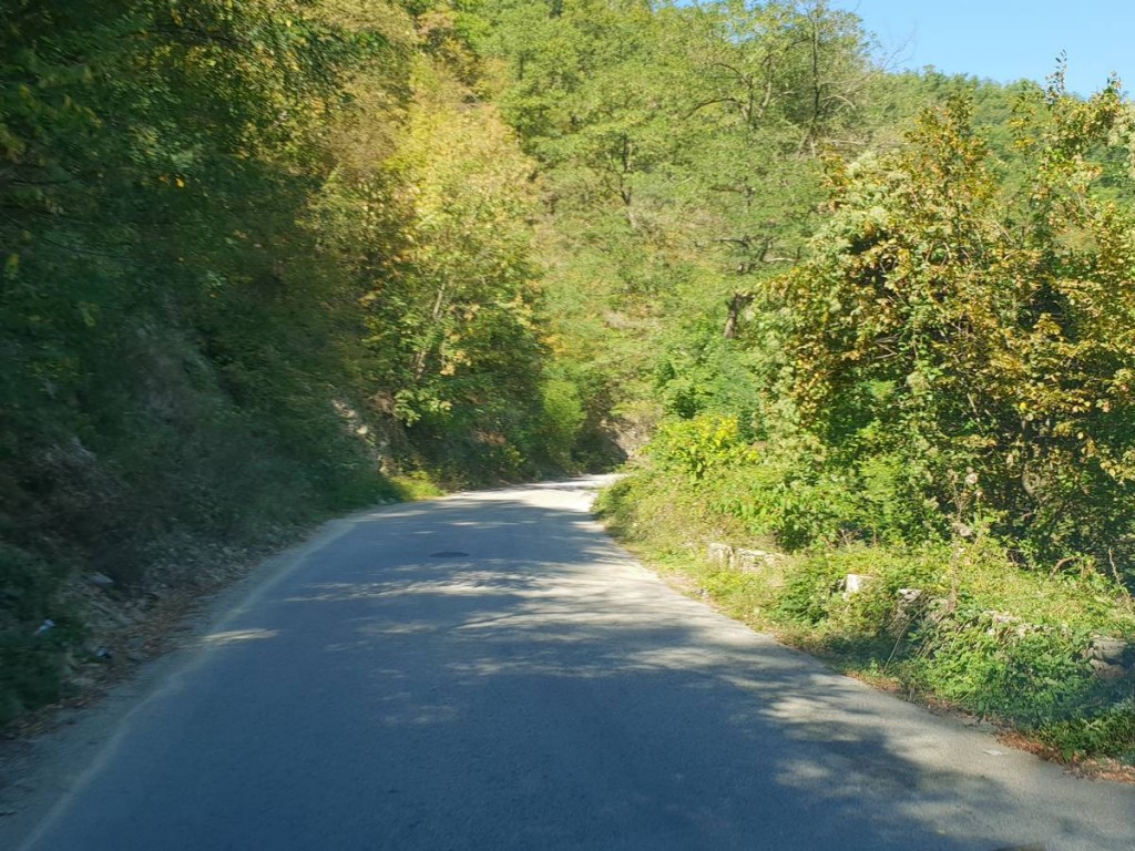
We leave Eselnita early this morning and pedal the Danube on DN57 towards the legendary carved sculpture of Decebal’s face. From here, we leave DN57 and climb north to Pregheda, halfway between Eftimie Murgu and Orşova, a road that is made only by forest, along a forest path.
The road from Eselnita is a crossing of Almăjul Valley and we climb to the peak of Svincea Mare, which is the highest point of Almajul Mountains, passing through the village of Eftimie Murgu. Sitting on the forest road to Pregheda mining, we are met by a mystical landscape and after the war – here in the area the earth is black because of the coal. In the absence of tourist attractions, the area is very little wandered, we can even say the world is forgotten. Here at Pregheda, we are at the border of Mehedinti and Caras-Severin counties.
Cycling route from Pregheda is a tour of exploitation, on rough terrain sometimes difficult to walk through the heart of Almăjul Mountains. That is why it takes some bike experience and a very good physical condition to complete this route.
From Pregheda mining we descend to Eşelnita, which is the point of arrival of our route through Valea Almăjului.
The hydropower system „Iron Gates I” and the Navigation System, which is a symbol of the Romanian energetic industry and which is the result of the Romanian-Yugoslav collaboration, was inaugurated on May 16, 1972. The Museum of the Iron Gates I Hydro Power Station was opened in 1976 and presents the general characteristics of the Danube, hydrological data, material evidence of human settlements in the region.
The museum exhibits folk costumes specific to the Iron Gates region and a water mill considered to be the precursor of the modern turbine, Pelton.
The biological diversity, the complexity of the geological substrate and the cultural values make the Iron Gates region a place with a scientific reputation internationally. The Iron Gates Gorge is considered to be an open-air geological museum. There is a variety of magmatic, metamorphic and sedimentary rocks. Because of the avifaunistic wealth, the Danube course in the Portile de Fier area was declared Sit Natura 2000.
The trip to the „Iron Gates I” Hydropower Museum ends with the Turbin Hall, where the visitor can admire the six Kaplan turbines, each with an installed capacity of 194.5 MW.
Trajan’s Bridge or Apollodor Bridge built above the Danube was a Roman bridge, the first bridge built over the Lower Danube. Although it was functional for only a few decades, for over 1,000 years it was the longest arched bridge.
The bridge was built in 105 AD. at the request of Emperor Trajan, by the Greek architect Apollodor in Damascus for the passage of Roman troops and supplies during the conquest of Dacia.
The bridge was east of the Iron Gates near the cities of today Drobeta-Turnu Severin in Romania and Kladovo in Serbia.
The structure was 1,135 m long (now the Danube has a width of 800 m in this area), the width of 15 m and the height of 19 m, measured from the surface of the river. At each end there was a Roman camp, each built around an entrance, so that the passage of the bridge was possible only by passing through the camps.
The bridge engineer, Apollodor of Damascus, used wood arches, each 38m wide, set on twenty brick masonry pillars, mortar and Pozzolan cement. The bridge was built unusually quickly (between 103 and 105).
The Danube’s Cauldrons have two bottlenecks – the Big Boilers and the Small Boilers. They are certainly the most impressive part of the Danube Gorge.
Prior to the construction of the Iron Gates Dam (Iron Gate Barrier) in this area, the entire flow of the Danube flowed through the narrow bed creating cataracts. The waters created choices that seemed to boil, hence the name of boilers.
The Danube’s Cauldrons are included in the Iron Gates Natural Park. The park’s symbols are the towers of Tricle, the Cazane’s tulip and the fossils of an ammonite. Of course, they refer to the three characteristics of the park: historical, botanical and geological.
The Danube’s Cauldrons Region is one of the 18 natural protected areas of the Portile de Fier Natural Park.
The entire area of the Danube’s Cauldrons, between the confluence of the Danube with the Plavisevita and Ogradena streams, measures 9 km.
Address: Bulevardul Carol 2, Drobeta-Turnu Severin 220111
Telephone: 0372 528 828
Address: 106A Tudor Vladimirescu Blvd.
Phone: 0743 128 658
Address: Strada Portului 1, Drobeta-Turnu Severin 220234
Telephone: 0372 528 828
The „Danube On 2 Wheels” Project is co-financed by the European Union though the European Regional Development Fund, within the INTERREG V-A Romania – Bulgaria Programme.
The total eligible value of the project is EUR 497.713,26, of which EUR 423.056,25 represents the value of the European Union contribution through the European Regional Development Fund.
The content of this website does not necessarily represent the official position of the European Union. The initiators of the site are the sole responsibles for the information provided through the site.
www.interregrobg.eu
Eselnita – Pregheda route
Touristic objectives in area
Museum of the Iron Gates Hydro-power Museum, Department of the Iron Gate Region Museum in Drobeta Turnu Severin
Foot of Trajan’s Bridge
Danube’s Cauldrons
Continental Hotel, Drobeta-Turnu Severin
Corona Hotel
Danube’s Spell Garden Restaurant
Do you want more details?
- About the project
- AISSER
- Useful information
- Indicators
- „Danube on 2 Wheels” Tourist Center (ACTIS Sport Club – Calarasi)
- „Danube on 2 Wheels” Tourist Center ( „Sport for you and me – Sports Club Canoeing” Association – Belogradchik)
- Duration – 1 day
- Distance – 67 km
- Total vertical climb – 1,380 m
- Surface – asphalt / forest road
- Bicycle Type – Race / MTB


AdvancedSend a message