Route route is Vraţa – Ruska Bela – Moravita – Mezdra – Kreta – Rebărkovo – Liutibrod – Zverino – Zlidol – Eliseina – Opletnea – Lakatnik Railway Station
It is a 2-day easy walk for advanced, which surrounds the Vratsa Balkan Natural Park on the east and south. We’ll be staying in Latnik Station.
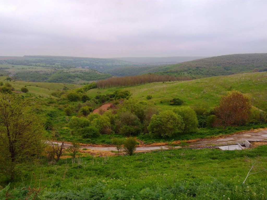
We leave from Vratsa in the morning, pass next to Grobishten Park and keep the national road 1 towards Mezdra until we intersect with the river Iskar – a tributary of the Danube, and the longest river that flows all over Bulgaria (368 km) – and then follow the course water to the west through the southern part of the natural park, and pedal through the streets of the national road 16 until we arrive at the Lakatnik Railway Station.
Lakatnik Station once made part of Lakatnik village, being the train station in this small town on the Sofia – Mezdra route. Over time, Lakatnik Station has become a separate settlement. It is near the Lakatnik rocks.
We will stay here overnight and we will rest, and from morning we will start on the same route, back to Vratsa.
Mogilanska Hill is located in the old town of Vratsa. Between 1965 and 1966, an archaeological research was carried out, and three tombs were discovered. Unfortunately, one of the tombs was robbed in antiquity, but the other two are preserved relatively well. The rich discoveries found here by archaeologists suggest that this is a royal tomb of the members of the tribal tribal Triballi (4th century BC).
One of the graves found a skeleton belonging to a young girl (height 145-150 cm), with a gold crown in the form of laurel branches weighing 250 grams, large gold earrings and other gold objects. There was a mirror in the girl’s left hand. Near the remains of the girl were discovered the remains of a man – a warrior with his armor, a carriage with two horses, ritually killed during the funeral, silver accessories (silver braid, silver ornaments and parts of the horse harness decorations), a sword , a bronze helmet and other items.
In the third grave (partially robbed in antiquity) there were the skeletons of a man and a woman, gold and silver objects, gold jewelery, clay objects, iron darts, and others.
The findings from the Mogilanska tomb are kept and exhibited at the Regional History Museum in Vratsa.
Vraţa Gorges are located in the Stara Planina Mountains – the Balkan Mountain Range in the Vratsa region – in the immediate vicinity of the picturesque town of Vratsa, about 300-400 m above sea level. The area is easily accessible from Vratsa – about 5 minutes by car or 10-15 minutes by bicycle – and the town of Vratsa is about an hour and a half drive from the capital Sofia.
The Vratsa Vest and the other rocks offer unique opportunities for climbing.
This is the highest waterfall in Bulgaria, whose thin stream of water falls from a mere 141 meters, just 1.5 km away from Vratsa.
The Skaklya waterfall is not active all year round, as under the hot summer heat, the water flow of the river that feeds it decreases a lot, and the waterfall is drying up. Thus, the best time to visit the Skaklya Falls is in the spring or after heavy rains.
The waterfall can be seen from the city, or you can go for a walk to enjoy the wonderful views of the waterfall.
The Vratsa Balkan Nature Reserve was declared a national park in 1989 and then Decree no. 987 of November 13, 2003, was designated as a natural reserve.
The park extends over an extended territory in northeastern Bulgaria, including almost entirely the Vratsa region of the Balkan Mountains chain (Stara Planina).
In May and June, more than 170 waterfalls can be seen in the park, 17 of which are active throughout the year.
An interesting waterfall is the Pine Rock Falls cascade, which takes its name from a nearby black pine. This waterfall is 63 meters high and is located near the village of Zgorigrad.
Due to its topographical diversity, its proximity to Vratsa and its numerous populated areas, the „Vratsa Balcanica” Nature Reserve is a favorite destination for ecological and alpine tourism.
Near the village of Lyutibrod there is the cart, four rock walls aligned one after the other. The inhabitants gave names to the formations because they have a strange resemblance to a wagon; due to their notched shape, also give the impression of a fortress in ruins.
There are 16 tourist routes along the Balkan Wing Natural Park, which cross a variety of natural landscapes and landmarks. Of these, 8 tourist routes are developed, with informative signs explaining the nature of each route: „The World of Ecology”; „Mountains for Beginners”; „A Forestry Trail of Story”; „The gulf of the rebellion – Skaklya – Vratsa waterfall,” Biological and karst diversity „,” The forest – the place where life is welcome „,” In the footsteps of the revolutionaries of Botev „and” The ancient and medieval gate „.
The park also offers three bicycle paths of varying difficulty.
Vratsata Pass, Vrachanski Balkan
Named „Vratiţa” in medieval times, the pass is an emblem of Vratsa and is linked to the name of the city.
It is declared a natural landmark and covers an area of 2 hectares. The pass is crossed by the road that leads to the Ledenika cave, the village of Zgorigrad, the tourist complex with the same name and the Parsheviţa chalet.
The pass is a gorge over the Leva River. The gorge offers beautiful landscapes and is „guarded” by an impressive rocky massif. The vertical rocks of the Vratsata Mountains are the highest on the Balkan Peninsula – over 400 m and are the most popular alpine objective in Bulgaria.
There are over 140 alpine trails with different difficulty categories, some of which are emblematic for Bulgarian climbing – such as „Mirrors”, „Second Congress”, „Vinkela”, „Dog’s Colts”, etc. The remains of the medieval „Vratiţa” medieval fortress from the X-XII century are preserved in the gorge.
The route begins at the exit of the village of Zgorigrad and follows the canyon of the Leva River. A climbing system formed by bridges and stairs on both sides of the river, after a two-hour drive, leads the tourist to the „Borov Kamak” waterfall, which amounts to about 63 meters. Until the big waterfall, you will encounter many other smaller waterfalls, which can be equally impressive, especially if you reach this area in spring or autumn when rainfall is abundant.
The most interesting part of the route is the fact that it passes under the cascade, which can be very refreshing in the warm season, but it is not recommended when the temperature is low. In some places, the route may be quite steep.
The route continues to the starting point of the waterfall. From here you can go back or continue to a nearby cottage. Above the waterfall you will find beautiful green meadows with shelter and barbecue area.
The way back is the same and lasts for an hour or more.
The monument of Hristo Botev is the first architectural sculptural monument in the Bulgarian Principality. The initiative for its construction belonged to the Mayor of Vratsa, Zeno Leonkev and to the chairman of the Standing Committee, Gyosho Antonov. The funds were collected mainly from donors, despite the fact that the initiative was supported by Stefan Stambolov – a close and associate friend of Hristo Botev, who at the end of the decade was prime minister.
The monument was inaugurated by Prince Ferdinand on 27 May 1890, and among the guests present were Prime Minister Stefan Stambolov, mother of Botev, his wife Veneta and his daughter Ivanka.
„Those who fall during the struggle for freedom do not die.” These words are carved in stone at the base of the Bulgarian revolutionary monument.
The sculpture portrait of the national hero Hristo Botev was made by Gustav Eberlayn with a small help from the young artists, especially at the head area. The monument depicts the poet in natural size, and on the base are the names of 190 rebels and fighters. The metal plates on the monument were made and written in Vienna.
The monument was dismantled in 1955 and in the early 1990s it was placed in the „Russian” garden. On June 2, 1964, it is a monumental unveiling that can be visited today in the „Hristo Botev” square.
The Kaleto fortress and the Kaleto archaeological complex in the Bulgarian town of Mezdra in northern Bulgaria is a 7,000-year-old fortified settlement with traces of civilized human life from all the Chalcolithic to the Middle Ages (Kale a Turkish word that means a „fortress” left over from the Ottoman period, frequently used for the many ruins of the ancient and medieval fortresses throughout Bulgaria, whose names are sometimes unknown.)
The Kaleto Fortress is located in the south-western corner of today’s Mezdra, on a rocky hill, on the left bank of the Iskar River. The earliest traces of civilized human life discovered here date back to the Chalcolith (Eneolithic, Copper Age) until the end of the 5th and the middle of the 4th millennium BC.
Remains of two fortified settlements from this period were discovered on the hillside, both being destroyed by forest fires.
Address: Bdul. „Yanko Sakazov” 42, 3100 Tsentar, Mezdra
Telephone: +359 91 091 033
Address: Sv.Patriarh Evtimiy 8, Mezdra
Phone: +359 91 092 701
Address: Bdul. „Ilinden” 57 A, 3000 Western Industrial Zone, Vratsa
Telephone: +359 88 777 8779
Address: Bdul. „Stefanaki Savov” 6, 3000 Vratsa Center, Vratsa
Telephone: +359 92 624 150
Address: bul. „Hristo Botev” 1, 3000 Vratsa Center, Vratsa
Telephone: +359 92 624 150
The „Danube On 2 Wheels” Project is co-financed by the European Union though the European Regional Development Fund, within the INTERREG V-A Romania – Bulgaria Programme.
The total eligible value of the project is EUR 497.713,26, of which EUR 423.056,25 represents the value of the European Union contribution through the European Regional Development Fund.
The content of this website does not necessarily represent the official position of the European Union. The initiators of the site are the sole responsibles for the information provided through the site.
www.interregrobg.eu
Route Vratsa – Lakatnik Railway Station and return
Touristic objectives in area
Mogilanska Hill, Vratsa
Vratsata Gorges, Vratsa
Skaklya Waterfall, Vratsa
Natural Reservation „Balkan Wing”
Vratsata Pass, Vrachanski Balkan
Eco-Trail Vratsa „Borov Kamak”, Zgorigrad
Monument of the National Hero Hristo-Botev, Vratsa
Fortress Kaleto, Mezdra
Torlatsite Hotel
Kevche Restaurant
Body M Hotel
Remus Restaurant
Hemus Hotel
Do you want more details?
- About the project
- AISSER
- Useful information
- Indicators
- „Danube on 2 Wheels” Tourist Center (ACTIS Sport Club – Calarasi)
- „Danube on 2 Wheels” Tourist Center ( „Sport for you and me – Sports Club Canoeing” Association – Belogradchik)
- Level – advanced
- Total vertical climb – 1370 m
- Duration – 2 days
- Distance – 174 km
- Surface – paved
- Bicycle type – cursor
AdvancedSend a message